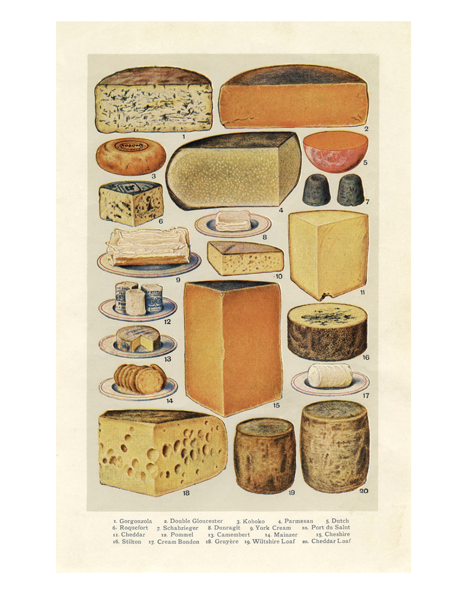
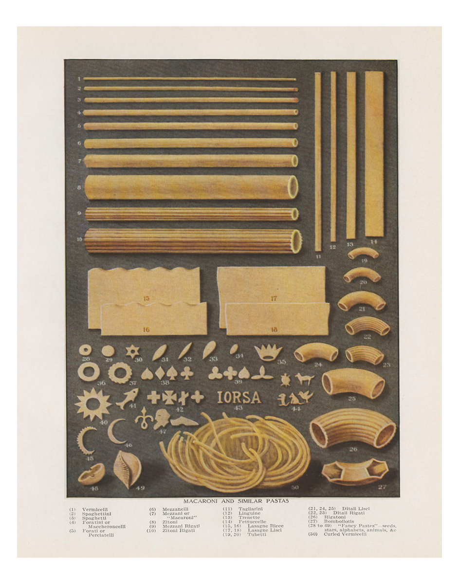
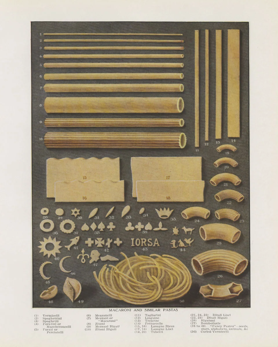
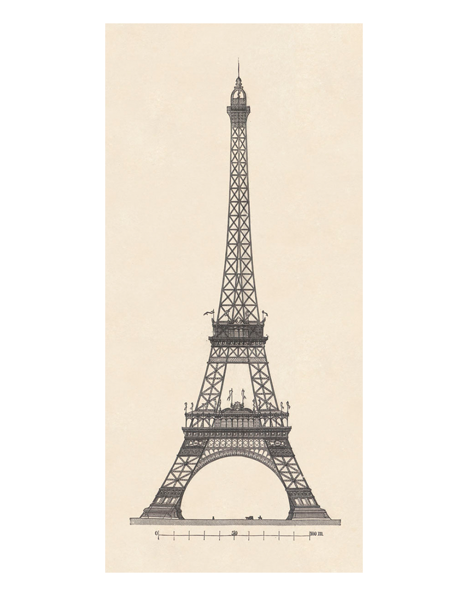
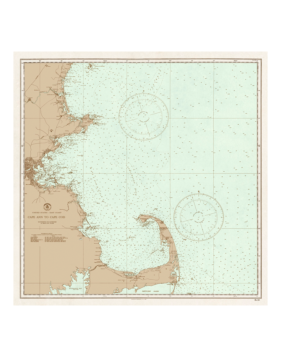
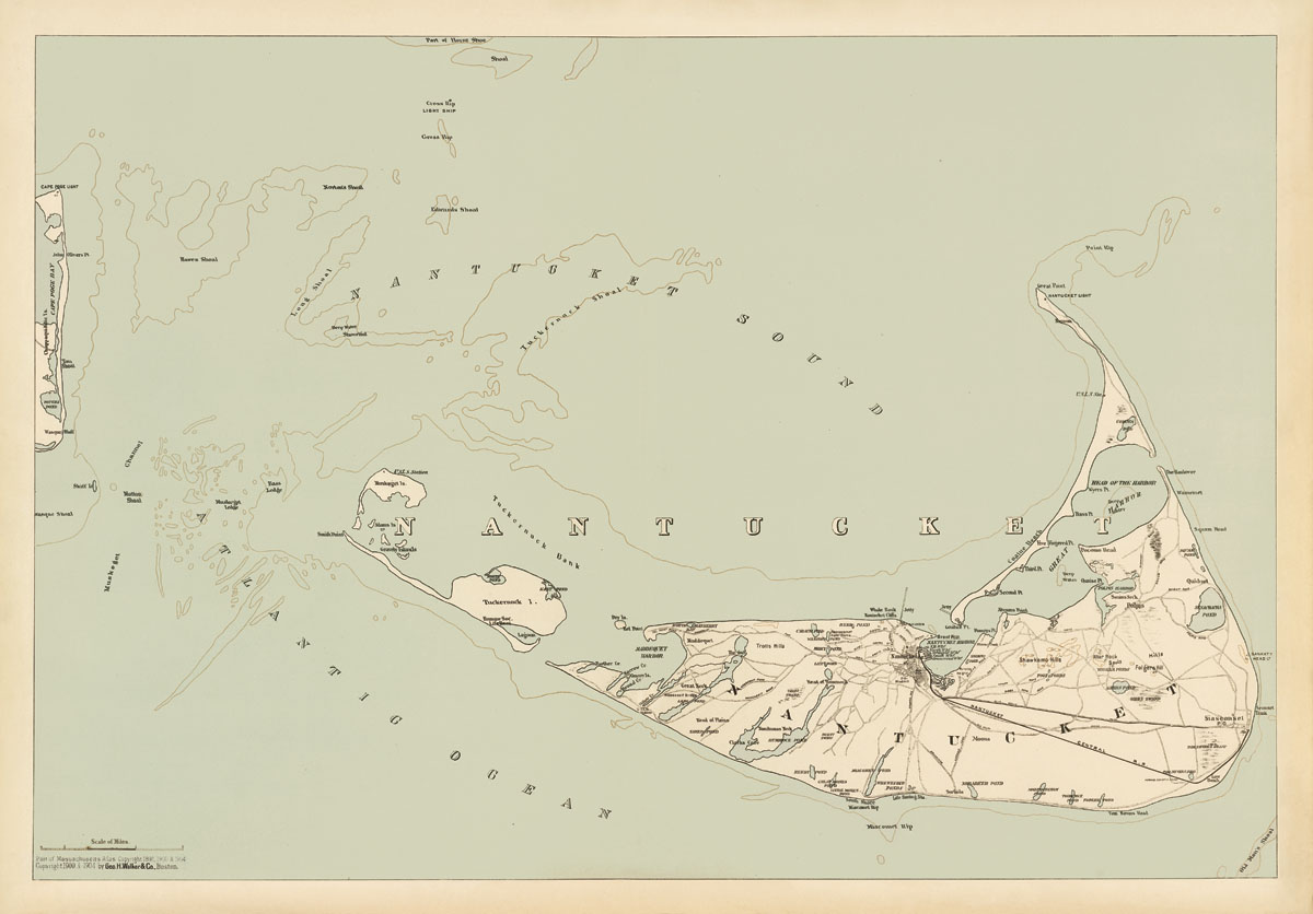
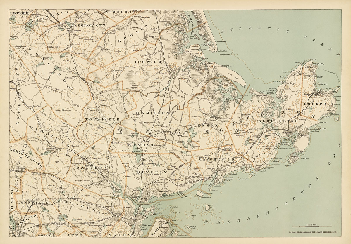
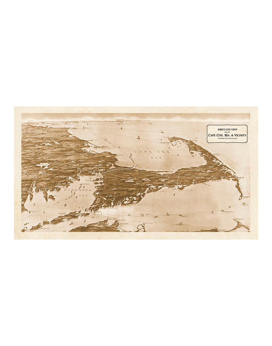
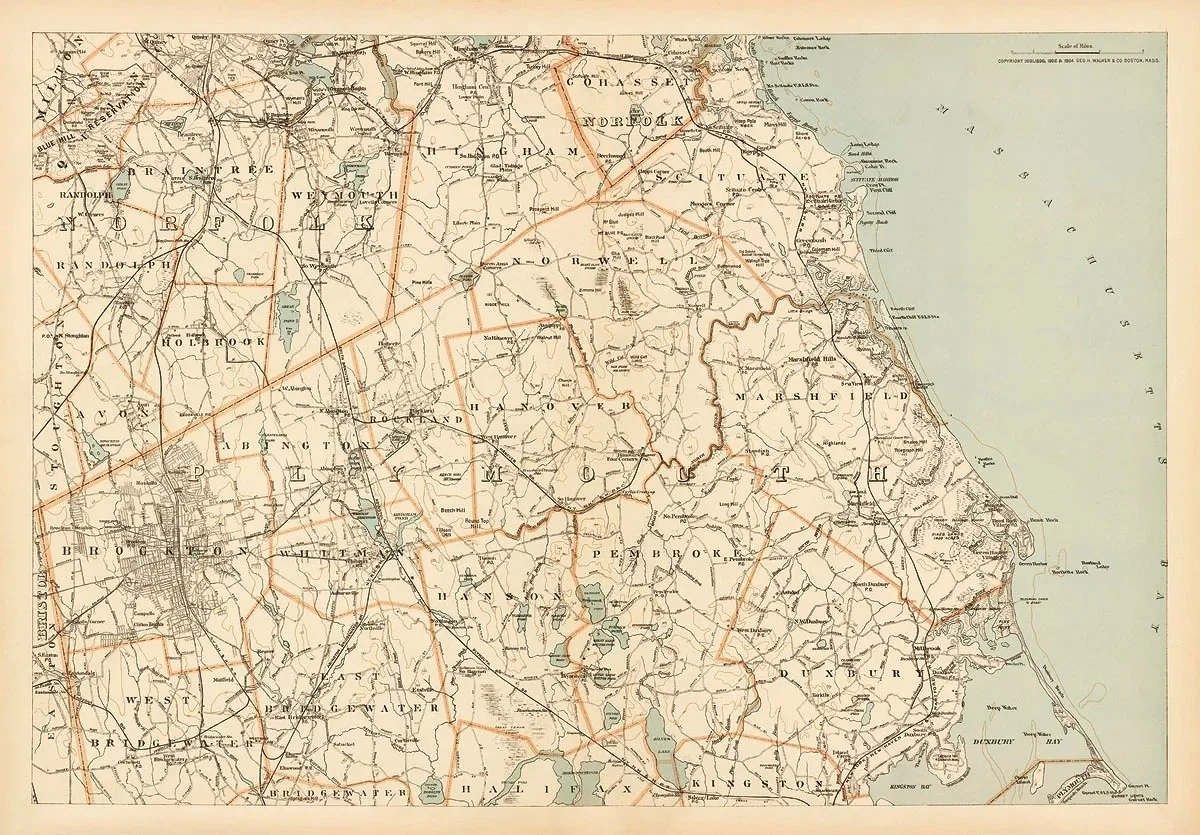
Shop Shop Clear All Botanicals & Flowers Animals Marine Life Scientific & Medical Mourlot School of Paris Miscellaneous Maps Recent Editions Best Sellers Filters Categories All Botanicals & Flowers Sepia Botanicals Buchoz Botanicals Silhouette Botanicals Deckle Botanicals Mughal Poppies Bright Flowers Ferns Fruit Animals Marine Life Scientific & Medical Mourlot School of Paris Georges Braque Marc Chagall Raoul Dufy Fernand Léger Henri Matisse Joan Miró Pablo Picasso Miscellaneous Maps World European United States New York Boston MA Coast & Islands Recent Editions Best Sellers Filter Clear Filter Two Whales from $25.00 Finback Whale from $25.00 Bowhead Whale from $25.00 Vineyard Stripers from $25.00 Nantucket Blues from $25.00 Compass from $18.00 Le Ciel from $25.00 Phases of the Moon, 1900 from $25.00 Localization of Brain Functions, 1887 from $25.00 Cheese (from a 1938 cookery book) $25.00 Pasta (from a 1938 cookery book) $24.00 Eiffel Tower from $24.00 French Line from $25.00 Eiffel Tower (navy blue version) from $24.00 Vintage Bicycles, 1906 from $32.00 Vintage Bicycles, 1906 (blue version) from $32.00 Vintage Bicycles, 1906 $25.00 Pirate Flags & Ensigns: The Jolly Roger from $25.00 Vintage Bicycles, 1906 (blue version) $25.00 Around the World (royal blue version) from $25.00 Around the World (navy blue version) $85.00 Around the World (gray version) $85.00 Map of the World (blue) from $25.00 Time of All Nations, 1906 from $25.00 Plan of Paris & Monuments, 1925 from $25.00 Plan of London, 1899 (blue version) from $25.00 Plan of London, 1899 from $25.00 The New York Guide, 1880 from $25.00 New York City (Lower Part), 1892 from $25.00 Map of New York & Vicinity (blue) from $25.00 Map of the City of New York, 1895. from $25.00 Map of the City of Brooklyn, 1895 from $25.00 Map of New York, Kings, Queens, Richmond, Rockland, Westchestr & Putnam Counties, 1895 from $25.00 Map of Suffolk County, Long Island, NY 1895 from $25.00 Map of Boston, 1871 - by Walling & Grey (sepia version) from $25.00 Map of Boston, 1904 from $25.00 Map of Boston, 1904 (blue version) from $25.00 Map of Boston, 1871 - by Walling & Grey (original colors) from $25.00 Index Map of Boston, 1906 from $25.00 New Map of Boston, 1902 $85.00 Plan of Boston, 1860 from $25.00 Boston Old & New, 1880 from $25.00 Boston Harbor, MA, 1904 from $25.00 Cape Cod, Martha's Vineyard & Nantucket, MA, 1904 from $25.00 Cape Ann to Cape Cod, MA - Nautical Chart (blue version) from $25.00 Cape Ann to Cape Cod, MA - Nautical Chart from $25.00 Nantucket, MA, 1904 from $25.00 Map of Cape Cod & Islands, MA, 1871 from $25.00 Martha's Vineyard, MA, 1904 from $25.00 Cape Cod, MA: Barnstable etc., 1904 from $25.00 Cape Cod, MA: Mid-Cape, 1904 from $25.00 Cape Cod, MA: Outer Cape, 1904 from $25.00 Massachusetts North Shore: Cape Ann & vicinity, 1904 from $25.00 Map of Romantic Boston Bay - published 1944 from $25.00 New York to Boston, Bird's-Eye View, 1927 from $25.00 Cape Cod, MA. & Vicinity, 1915 from $25.00 State House - Boston, MA, 1906 from $25.00 Plan of Paris & Monuments, 1925 (blue version) from $25.00 Plan of London Bridge from $25.00 Plan of London Bridge (blue version) from $25.00 PP1659 Massachusetts South Shore: Scituate, Marshfield, Duxbury & vicinity, 1904 from $25.00 No results found No results match your search. Try removing a few filters. Previous